Schleptruper Egge
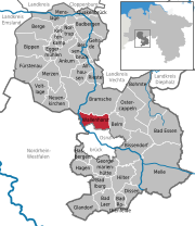
The Schleptruper Egge is a hill, 148 m high, in the Bramsche parish of Schleptrup and is part of the Wiehen Hills. To the north is the bog of Großes Moor at a height of about 47 m above sea level (NHN), the Mittelland Canal built in the 20th century and the Bramsche parish of Kalkriese. Immediately east of the Schleptruper Egge runs the A 1 motorway, the so-calle Hanseatic Line (Hansalinie).
Read article


Top Questions
AI generatedMore questions
Nearby Places

Bramsche
Town in Lower Saxony, Germany
Wallenhorst
Municipality in Lower Saxony, Germany

Darnsee
Osnabrück Canal
Artificial waterway in central Germany

Düte
River in Germany

Pye (Osnabrück district)
District in Lower Saxony, Germany
Holdorf (Oldb) station
Railway station in Holdorf, Germany

Kalkrieser Berg
Hill in Osnabrück, Germany